| Location | |
|---|---|
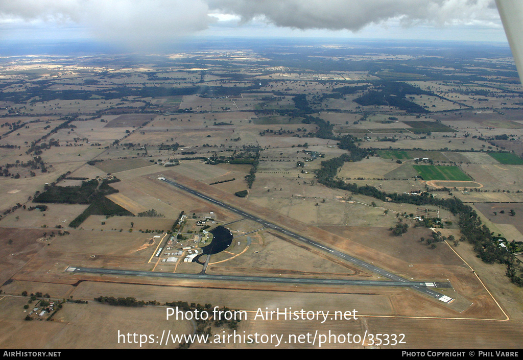
| City / Airport: | MangaloreMap |
| Region / Country: | Victoria, Australia |
| Airport Codes: | ICAO: YMNG IATA: - Local: - Other: - |
| Date & Photographer | |
|---|---|
| Photo Date: | 22 April 2006 |
| Photo by: | Phil Vabre |
| Photo ID: | 35332 |
| Photo Comment |
|---|
|
Orginally an RAAF base, Mangalore was developed after the Second World War as a diversion aerodrome for when Melbourne/Essendon was fogged in, its location north of the Great Dividing Range giving it good weather when the weather in Melbourne was bad. The field is much as it was then, except the hangars closest in the photo which are of relatively recent construction. The nearest runway is 1461m 18/36 with 2027m 05/23 behind, the photo looking west. This photo is copyright © Phil Vabre, and may not be used or published in any way without permission. It was added on 27 January 2018, and has since been viewed 192 times. |